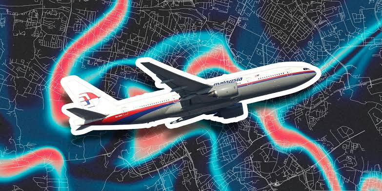
The disappearance of Malaysia Airlines Flight 370 (MH370) remains one of the greatest aviation mysteries in history. In 2014, the Boeing 777 carrying 239 passengers vanished from radar during its flight from Kuala Lumpur to Beijing. Despite years of searching and speculation, the aircraft’s exact location remains unknown. For many, the possibility of solving the MH370 puzzle lies in the tools we use every day, such as Google Maps.
But can something as accessible as Google Maps help track down the missing plane? Let’s explore what has been said about Malaysia Airlines Flight 370 and Google Maps, and whether it’s possible for the platform to uncover clues.
The Curiosity Around Google Maps and MH370
In the years following the disappearance, Google Maps enthusiasts and online sleuths turned to satellite imagery to look for clues about the flight’s final resting place. The platform, known for its ability to display satellite images of almost any location in the world, seemed like a potential goldmine for identifying debris or even the wreckage of the plane.
People across the globe, sitting in the comfort of their homes, scoured vast expanses of oceans and remote areas, hoping to spot something that official search teams might have missed. This led to various claims of sightings of MH370 on Google Maps. However, none of these claims have provided concrete evidence that the plane has been located. Yet, the question lingers: Is it even possible?
Can Google Maps Really Help Find MH370?
Google Maps is a powerful tool that allows users to view satellite imagery of almost any part of the world. But is it detailed enough to find something as specific as a missing plane?
- Satellite Coverage: Google Maps doesn’t provide real-time satellite images. The platform uses satellite imagery that can be weeks, months, or even years old. This means that any debris or wreckage floating on the ocean’s surface might not appear in the most recent images.
- Resolution Limitations: While the detail on Google Maps is impressive for everyday users, it isn’t high enough for specialized searches. Google Maps uses lower-resolution images, meaning that smaller objects, such as fragments of a plane, could easily go unnoticed.
- Oceanic Depths: The vast majority of the world’s oceans are unexplored and incredibly deep. If MH370 lies on the ocean floor, satellite imagery, even at its best resolution, wouldn’t be able to detect it. Underwater searches, using sonar and deep-sea submersibles, are still the best tools for such tasks.
Notable Google Maps ‘Finds’ and Why They Don’t Hold Up
Over the years, there have been several instances where people believed they found MH370 on Google Maps. Some users claimed to have spotted airplane-shaped objects in different parts of the world, from the Cambodian jungle to the Indian Ocean. However, these sightings were later debunked for a few reasons:
- Visual Artefacts: Sometimes, glitches or distortions in satellite imagery can cause objects to appear when they are not really there. These artefacts can be misleading, especially when viewed at certain angles.
- Old Data: The satellite images on Google Maps might not be recent. This is particularly problematic when searching for something like a plane wreckage, which may no longer be in the same place as it was when the image was captured.
Despite these limitations, public interest remains high. People are still intrigued by the idea of spotting MH370 on Google Maps, even though experts have mostly ruled it out as a viable method.
The Official Search for MH370
The official search for MH370 involved some of the most advanced technology and equipment available. Over the course of several years, search teams from multiple countries scoured vast sections of the southern Indian Ocean. While some debris was eventually found on the shores of islands such as Reunion, the main wreckage of the plane has yet to be located.
The underwater search, led by international teams, used sonar equipment and deep-sea drones. They mapped areas of the ocean floor never before explored by humans. Despite these efforts, MH370’s location remains a mystery, proving just how challenging the search has been, even with the most sophisticated technology available.
Why the Google Maps Theory Persists
The idea that a missing plane could be found using Google Maps persists for a couple of reasons. First, it gives everyday people the feeling that they can contribute to the search for answers in a global mystery. Second, it taps into the power of crowd-sourcing—where millions of people working together can achieve something that a small team of experts might miss.
In fact, crowd-sourcing has worked in some cases. For instance, platforms like Tomnod allowed users to search satellite imagery after natural disasters, helping locate stranded individuals. But with MH370, it’s important to recognize the limitations of both the technology and the images available.
Conclusion
While the search for malaysia airlines flight 370 google maps, it’s unlikely that Google Maps will provide the breakthrough many hope for. The technology, while powerful, has its limitations, especially when searching vast, uncharted ocean territories. Still, the idea of finding MH370 using Google Maps captures the imagination of people worldwide.
In the end, the mystery of MH370 remains unsolved, and while tools like Google Maps can inspire hope, the search for answers lies in more advanced, specialized methods.
Frequently Asked Questions (FAQs)
1. Can Google Maps find Malaysia Airlines Flight 370?
Google Maps is not equipped to find MH370 due to limitations in resolution and satellite image recency.
2. Have people claimed to see MH370 on Google Maps?
Yes, several individuals have claimed to spot the plane using Google Maps, but these claims have not been proven.
3. Why is it difficult to find MH370?
The plane likely lies deep underwater in a vast, remote part of the ocean, making the search extremely challenging.
4. What tools are being used to search for MH370?
Search teams use sonar, deep-sea drones, and other advanced technologies to explore the ocean floor.
5. Has any wreckage from MH370 been found?
Yes, some debris from MH370 has washed ashore on islands in the Indian Ocean, but the main wreckage remains missing.